
The Land That Moves
2026 · 25 min read
What's a Quorum?
I asked the question because I wanted an answer. We were sitting in a small meeting room at the southern tip of the Palos Verdes Peninsula. Eighty-one lots, five streets, dues of less than twenty dollars a month. The agenda had outrun the budget some time ago: a community path damaged in the storms two years back, a neighbor dispute over coastal access, a year of legal fees in a lawsuit nobody had won, the city's continuing effort to rezone a vacant parcel inside our community to high density to satisfy a state mandate from Sacramento. Annual budget under three hundred dollars per household. Not a war chest.
What is a quorum, anyway, I asked. How do we actually decide anything around here. And if we agree, does it matter.
The room went quiet.
A couple of longtime owners said it was complicated. It was all in the bylaws, somebody said. The bylaws had last been revised in 2009 — the last time, as far as anyone could remember, that the association had achieved a quorum. They needed updating. They probably did. Davis-Stirling has changed since then. The state has changed since then. The hill has changed since then.
The conversation moved on. The question did not.
I went home and pulled the bylaws, the declarations, the deeds, the maps, every recorded instrument I could find that touched these eighty-one lots. I have spent the months since reading them. What follows is what I found.
The Layers
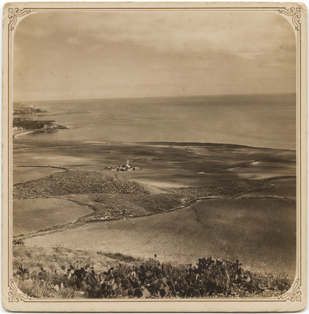
This stretch of coast was never ordinary land. Beneath it is bentonite clay that has been sliding into the Catalina Channel for a hundred thousand years. Above it, a hundred and forty years of deeds, declarations, partition maps, coastal plans, and moratorium ordinances stacked on top of each other like sediment. To understand what is happening at one vacant lot today, you have to see what is layered underneath.
The land has changed sovereigns four times. In 1784, a sixty-three-year-old Spanish soldier named Juan José Dominguez petitioned Governor Fages at Monterey for a permit to run cattle over the hills above the harbor of San Pedro. It was the first private land use grant in California history. After the Mexican Revolution, the Sepulveda family secured the portion known as Rancho Palos Verdes; on June 4, 1846, the last Mexican governor, Pío Pico, granted them formal title — twenty-three days before Commodore Sloat raised the United States flag over the Monterey customs house and claimed California for the Union. The U.S. Land Commission confirmed Sepulveda title in 1853.
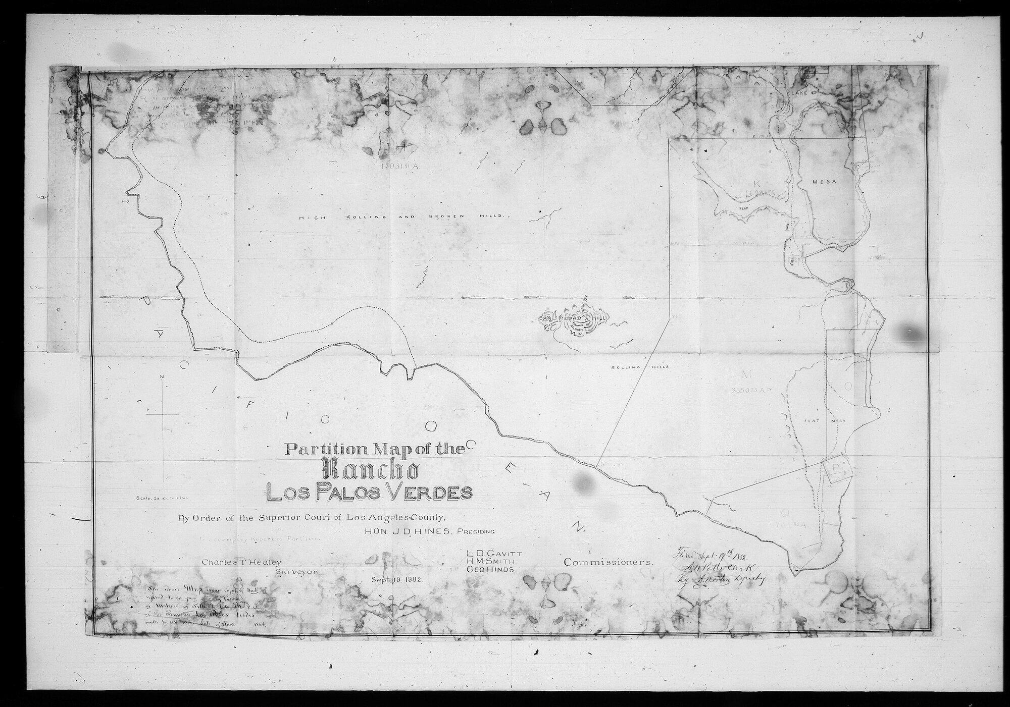
It did not last. The droughts of the 1860s shattered the rancho cattle economy across Southern California. Tens of thousands of head died. Debts mounted, land values collapsed, and the Mexican-era estates were carved up and sold. By 1882, a Superior Court partition in Bixby et al. vs. Bent et al. (Case No. 2373) awarded the bulk of the rancho — 16,002 acres — to Jotham Bixby. The partition created Lot H. If you stand on the Palos Verdes Peninsula today, you stand on a portion of Lot H. Every tract, every subdivision, every road, every park has been carved out of it.
The Bankers
Bixby and his syndicate held the land for thirty years and exited in 1913. The buyer was Frank A. Vanderlip — a Wall Street banker, former Assistant Secretary of the Treasury under President McKinley, and one of the architects of the Federal Reserve. Three years earlier, Vanderlip had attended the secret meeting on Jekyll Island, Georgia, that drafted the plan for a central bank capable of stabilizing the currency and backstopping the rise of the United States as the world's financial power. He bought the peninsula sight unseen. According to Col. Robert M. Baughey of the Palos Verdes Corporation, writing in 1947, Vanderlip conducted all of the negotiations and assumed full responsibility, and closed the deal without first having seen the property.
He hired the Olmsted Brothers to draw the plan. The first Olmsted plans for the peninsula are dated 1914.
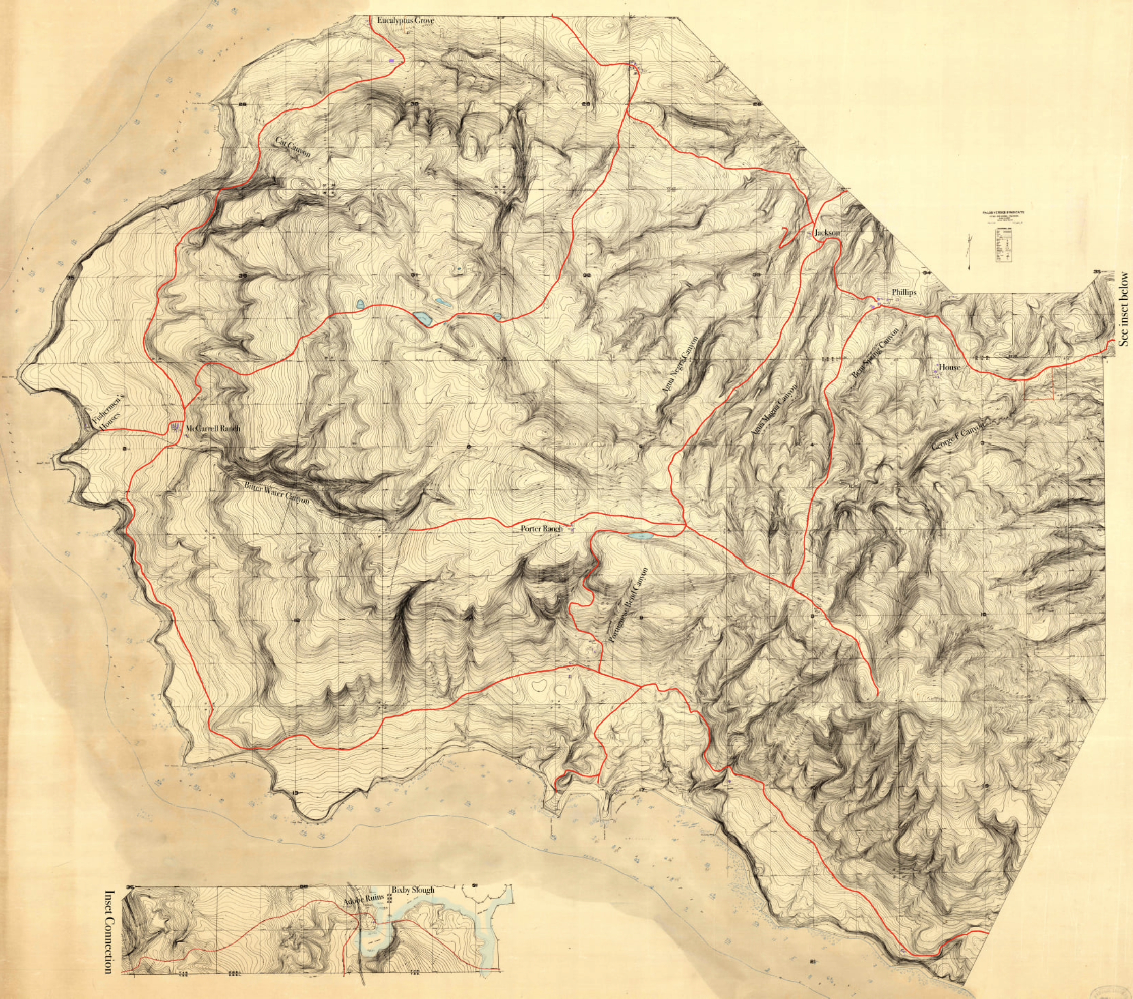
To make the plan binding on the land — to make it survive him — Vanderlip and his partners recorded a series of private declarations. Declaration No. 1, recorded January 25, 1923, established the framework anyone familiar with Palos Verdes Estates already knows: the Malaga Cove and Miraleste red tile districts, the Art Jury, the Mediterranean architectural standards, the boulevards, the walkable village centers. Declaration 1 is famous.
Less famous are Declarations 100 and 101, recorded six years later. Declaration No. 100 was dated October 7, 1929, and recorded in Book 9436, Page 155. Declaration No. 101 was dated October 14, 1929, and recorded in Book 9482, Page 37. Together they extended the same Art Jury framework, the same Community Association, and the same general plan of development to seven specific parcels along the south coast — including the parcels at Portuguese Bend and Abalone Cove. A grant deed recorded August 15, 1930 in Book 10226, Page 170 transferred three portions of Lot H from the Palos Verdes Corporation to the Filiorum Corporation for ten dollars. That deed expressly incorporated each and every provision, condition, restriction, reservation, lien, charge, easement and covenant of Declarations 100 and 101 — as fully and completely as if herein set forth in full.
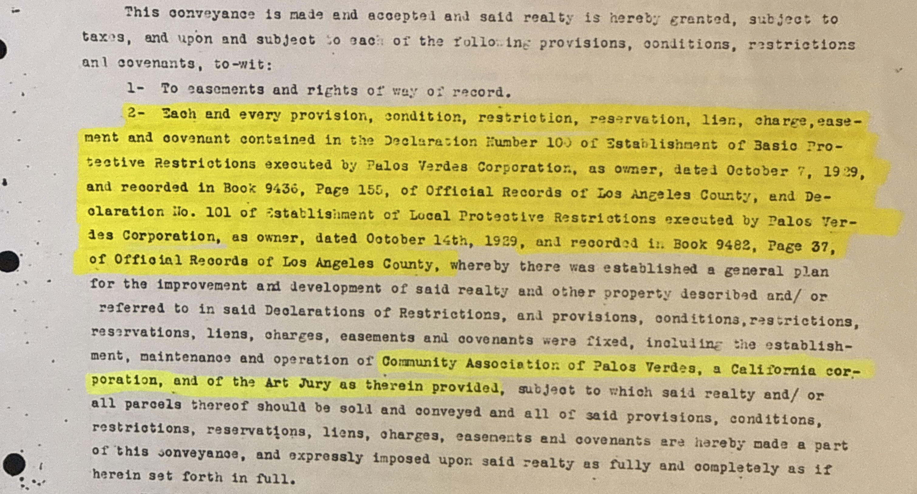
These restrictions still run with the land. They have been sitting at the county recorder's office for the better part of a century, and almost nobody has read them.
What the Land Did
The plans bound the future the family hoped for. The land had its own ideas.
The Portuguese Bend landslide reactivated in 1956 and has been moving ever since. After the Abalone Cove landslide reactivated in 1978, the City of Rancho Palos Verdes — incorporated in 1973 to gain local control over coastal development — adopted both its first Coastal Specific Plan and its Landslide Moratorium Ordinance. The moratorium prohibited new construction on undeveloped land within the twelve-hundred-acre slide zone. In 2008, the California Court of Appeal in Monks v. City of Rancho Palos Verdes held that the blanket prohibition amounted to an unconstitutional taking. The city was forced to amend the ordinance and create a case-by-case exception process. The moratorium survived.
In August 2025, the City Council made the prohibition on new residential construction permanent across the Greater Portuguese Bend Landslide Complex, effective September 2025. Repairs and replacements within existing footprints remain allowed. New development on vacant land does not.
The federal record is thicker still. The Endangered Species Act protects habitat for the Palos Verdes Blue Butterfly here. From 1947 to 1982 the Montrose Chemical plant in Torrance discharged an estimated 1,700 tons of DDT through the county sewer outfall at White Point; an estimated 110 tons remain on the Palos Verdes Shelf, covering seventeen square miles of ocean floor. The $140 million Superfund settlement in 2000 was the largest non-oil environmental damages recovery in U.S. history. Fish consumption advisories have been continuously posted since 1985. The Governor declared a state of emergency for the area in September 2024. FEMA is funding a $42 million voluntary buyout program for severely impacted properties. The land moves. The water is contaminated. The federal government is already here.
Condos or the Beach — Again
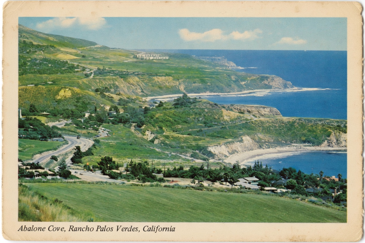
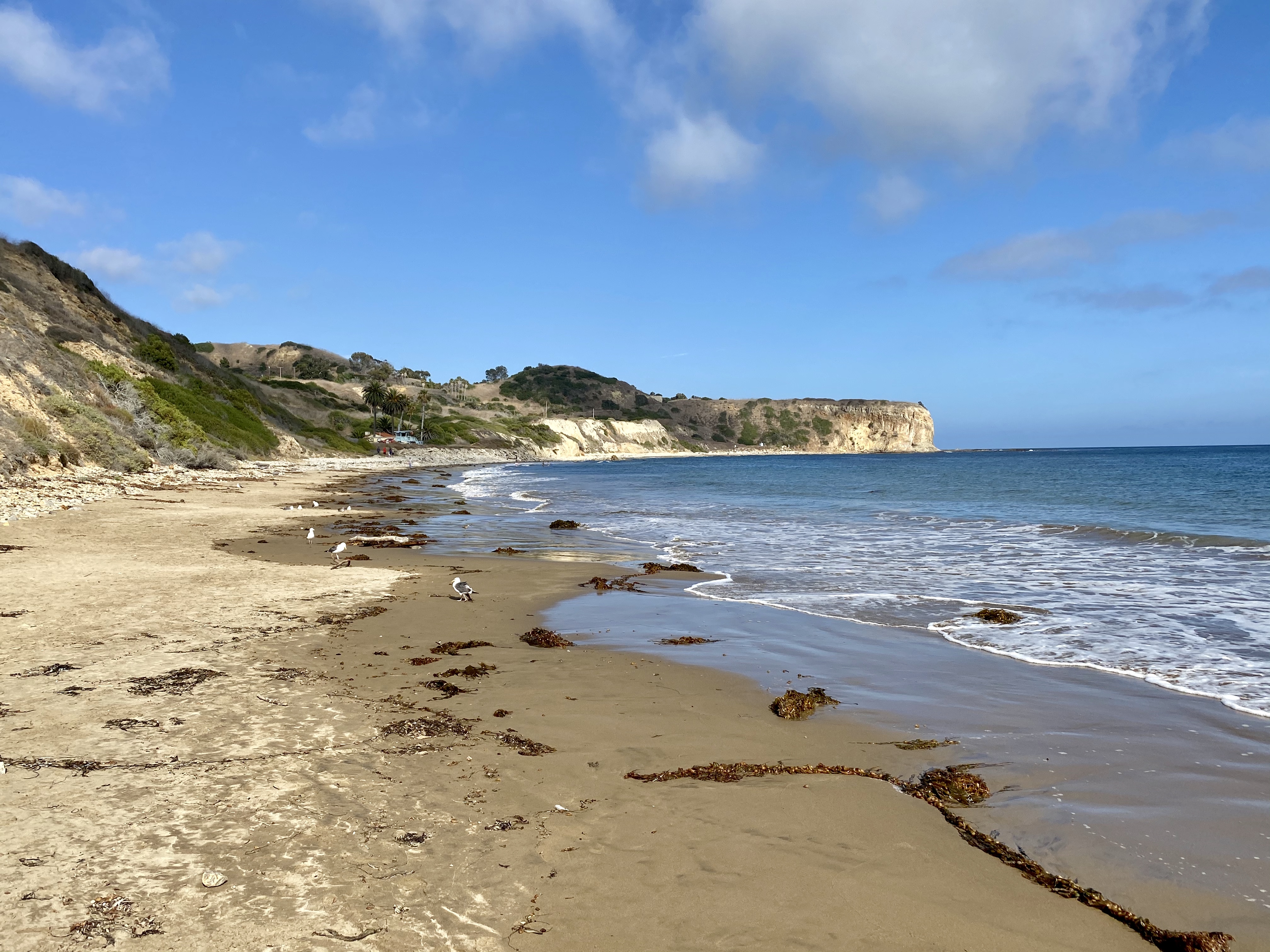
In 1972, the community that used Abalone Cove faced a question almost identical to the one I sat in that meeting trying to ask. A Beverly Hills attorney, Karl Rodi, proposed building 138 to 170 condominiums on Portuguese Point. The Los Angeles County Department of Beaches pushed instead for a public shoreline park. The then-president of the Abalone Shore Club organized the vote. The community chose the park. That is why Abalone Cove Shoreline Park exists today.
The 1972 vote did not happen in isolation. The two-thirds of the Palos Verdes Peninsula that was still unincorporated in the early 1970s — every parcel south and east of Palos Verdes Estates and Rolling Hills, including all of what is now Rancho Palos Verdes — was governed by the Los Angeles County Board of Supervisors and the County Regional Planning Commission. The county was the entity issuing zone changes. The county was the entity approving the densities. And the county, by the early 1970s, was approving densities that the residents who lived on the peninsula did not recognize as the place they had moved to.
Marilyn Ryan moved to what would become Rancho Palos Verdes in September 1967. She was active in the local League of Women Voters, ran for the first RPV City Council in 1973 — the year of incorporation — and won. She became the city's first mayor and signed the city's first General Plan and its first EIR in 1975. She was then elected to the California State Assembly in 1976 and served through 1982, where she helped pass the California Coastal Act. Her UCLA / California State Archives oral history, taken in November 2000 and the early months of 2001, is the best primary-source narrative on the record for why Rancho Palos Verdes exists as a city.
Her account is plain. The League of Women Voters chapter she chaired had taken the position that what the peninsula needed was local control of land use — either annexation to one of the cities that already existed, or, failing that, forming a city of its own. The activists working the incorporation effort, she said, sounded "absolutely paranoid about the county" — describing zone change after zone change, apartments proposed up here, density increased over there. She was skeptical at first. Then she got involved. Her conclusion, in her own words on the oral history record: "the county really was bad." Residents would go down to the county to fight rezonings. They won some and lost others. And they came to the conclusion that the only durable answer was to take local control by incorporating.
That is why Rancho Palos Verdes exists. Not as an abstraction. The city was founded by residents who had been fighting county-approved high-density rezonings, who had organized through the League of Women Voters and Save Our Coastline, and who had concluded that local control of land use was the only mechanism that would hold. The city's first mayor said so on the record.
Fifty-three years after the city was founded, the question has come back to a different parcel three streets away. The city the residents incorporated to stop the county from approving condominium density on this coastline is now itself the entity approving condominium density on this coastline. The mechanism has changed — state housing-element pressure has replaced county zone-change discretion — but the underlying decision is the same one the city's first mayor and her contemporaries got into civic life to prevent.
The Wong Subdivision and the Rezoning
In 1980, the 1.58-acre vacant lot at 0 Clipper Road was subdivided into four single-family building sites and one common-area open space parcel covering the clearly marked flood hazard area. Tract 32977. That was the density the city considered appropriate for this land. Six years later, for reasons the record does not explain, the subdivision was reversed back to a single parcel. Tract 43725. The flood hazard notation carried forward. The previous owner held the parcel for sixteen years and was repeatedly told no when he tried to do more with it. In October 2021 it sold to Clipper Development LLC for $2.2 million. In November 2025 a $2.1 million commercial loan secured by the parcel was issued by Hankey Capital.
In April 2024, the Rancho Palos Verdes City Council passed an urgency ordinance rezoning the parcel from RS-4 to RM-22 — single-family residential to multi-family, twenty-two units per acre. A second urgency ordinance followed on June 4 and a regular ordinance on June 18. Three ordinances in sixty-three days. The proposal called for sixteen units. The city calculated density on the full 1.58-acre parcel; the assessor's maps show a flood hazard easement that reduces the usable area to roughly an acre.
On June 4, 2024, an attorney representing eighty homeowners in Abalone Cove submitted a thirty-nine-page letter to the city council opposing the rezoning. On August 7 an FPPC complaint was filed. On September 11 a writ of mandate was filed in Superior Court (Case No. 24TRCP00352). In January 2025, the California Department of Housing and Community Development confirmed in writing that the city could remove the parcel from its housing element and remain RHNA-compliant. In June 2025 the city council voted to keep it anyway.
If the rezoning is theoretical, as the city's housing consultant has assured — a paper exercise to satisfy Sacramento — there is a question why a parcel on an active landslide is being rezoned at all. If it is not theoretical, the assurance is not accurate. The commercial loan suggests the latter.

What I Found in the Box
None of this research would have been possible five years ago, not for one person working alone.
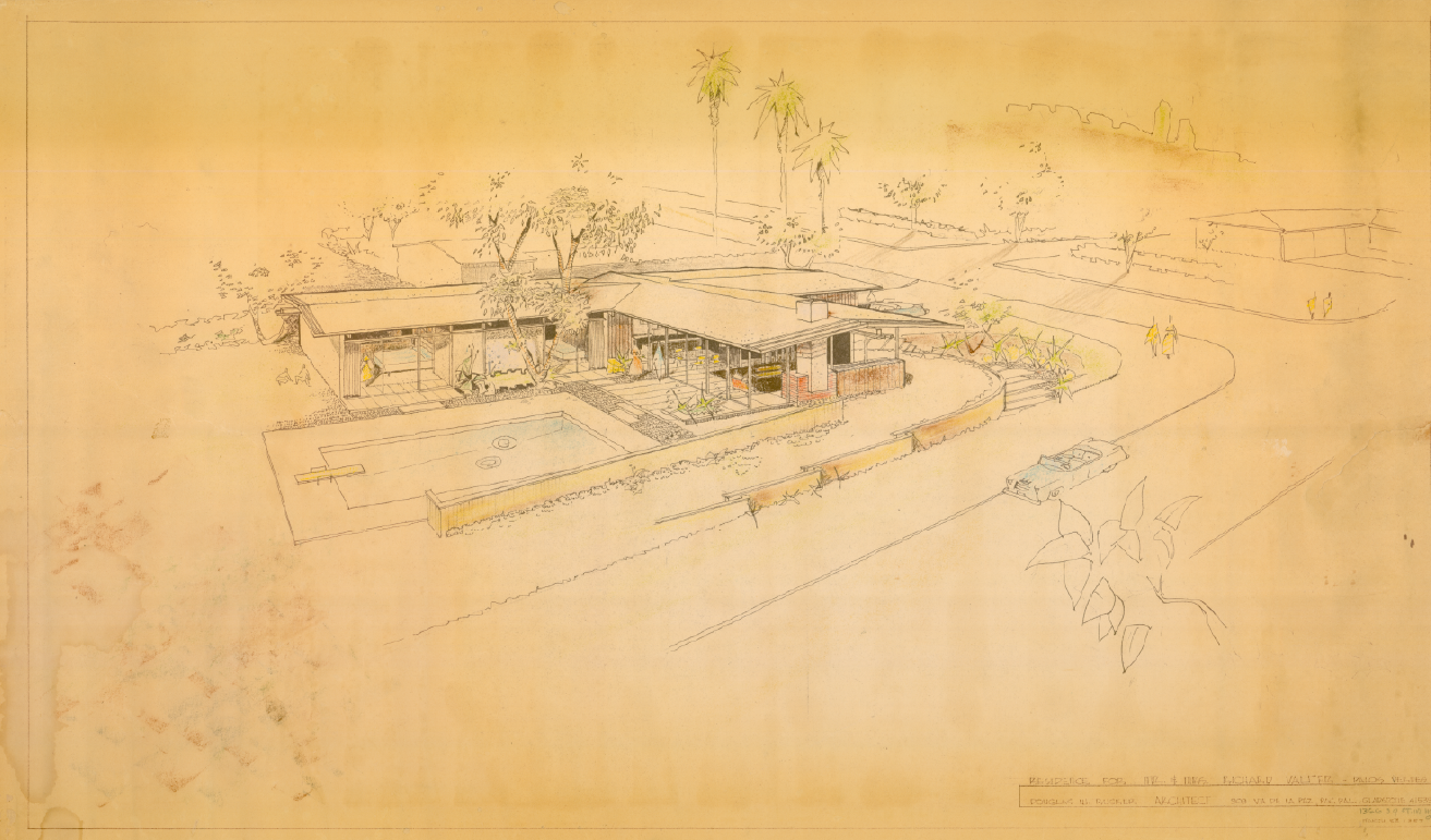
The previous owner of the house I live in had served on the HOA board in the 1950s and as a director of the Abalone Shore Club, the private beach club that leased property from the Vanderlip family. When she sold, she left documents in the garage. A couple of banker boxes and a mailing tube, sitting untouched for twenty years. They were not random papers. They were the archives of someone who cared. Hand-drawn parcel maps, handwritten notes, pristine copies of the city's own filings. She had been an architecture student. Her house had been designed by a fellow classmate, Doug Rucker, AIA. It was his first professional commission. The original rendering survived in the box.
I started scanning. One document at a time. Recorded declarations. Engineering drawings. County road department field books from the 1930s. Assessor parcel maps. I used modern AI tools to process the scans — to compare legal descriptions across documents, to flag matching metes and bounds, to surface book-and-page references buried in the corners of forty-year-old blueprints. The microfilm at the Los Angeles County Recorder's Office is poor quality on the oldest documents, and there are gaps. But the timeline is now assembled, and the contradictions in the public record are visible to anyone who wants to look.
What one person can do now used to require a law firm, a title company, and a surveyor.
The first thing I learned was that the Lot H Declaration of 1950, which I had assumed contained the architectural protections I was looking for, in fact contained only a racial covenant — now void under California law. The protections I had imagined were not there. That correction changed the strategy. The arguments for protecting this land are geological, environmental, and procedural. They are not, primarily, CC&R-based.
The real discovery came from a notation on a thirty-by-forty-inch county engineering drawing. A book-and-page reference written small, in pencil, on a 1930s survey of Palos Verdes Drive South. I pulled the referenced document. It led to Declaration 100, and through it to Declaration 101. The 1930 Filiorum grant deed, recorded six years later. The same Art Jury framework. The same Community Association. The same red tile district. Written on the same typewriter, signed by the same family — Kelvin C. Vanderlip on both sides of the page, as president of the land corporation and as president of the association at once. Recorded in 1929 and 1930. Sitting in plain sight for ninety-six years. Almost nobody had read them.
In 2014, when California dissolved its redevelopment agencies, the Successor Agency to the RPV Redevelopment Agency conveyed eleven properties back to the city by grant deed. Five of them are the Abalone Cove Shoreline Park parcels. Their legal descriptions reference the same Lot H partition map, the same Filiorum Corporation deed, the same parcels described in Declaration 101. The Long-Range Property Management Plan filed under state oversight in 2014 acknowledges, parcel by parcel, that CC&R restrictions exist and may constrain development. Declarations 100 and 101 are not named in any of the 2014 instruments. Whatever ran with the land came with it. The city's own filings say so.
A Reset Clause
There was one more thing in the verbatim of Declaration 100 that I have not yet mentioned. It is in Article II, Section 5.
The clause provides that if the Community Association of Palos Verdes — the body the 1929 declaration created to enforce its restrictions — has failed to meet or act for more than ninety consecutive days, fifteen owners of record title on fifteen separate parcels within the original Declaration 100 boundary may publish notice, hold a meeting, and elect three Trustees. The Trustees inherit the full enforcement authority that Article II Section 4 grants the Association. Twenty-six powers, enumerated. Including the authority to record a Restated Declaration that re-affirms the surviving Declaration 100 and 101 covenants on the chain of title.
The clause is self-executing. It does not require permission from the city, the state, or any tribunal. It is a procedure the recorded instrument provides for itself, written into the document at the time of recording almost a century ago.
The ninety-day condition precedent has been satisfied for decades. The body the Vanderlips created in 1929 to enforce these particular instruments has not been sitting in that role for ninety-five years. The clause has been waiting in the document the entire time, on file at the Los Angeles County Recorder's Office at Book 9436, Page 155, available to anyone who chose to read that far.
I am not a lawyer. I have not invoked anything. I have read the document. What it says, the document says. Whatever happens next, the body the family built to defend this land has, written into its constitutional architecture, the reset clause the family wrote.
Listening to the Land
Drive Palos Verdes Drive South past the fire station today. The road is cracked. City works signs lean. Flashing electronic signs warn of dangerous conditions. The ground beneath the fire station, which sits on land carved from Parcel 106 — the same remainder strip that borders the vacant parcel at 0 Clipper Road — is moving. Walls in homes along this corridor crack a little each day.
The HOA the family built in 1949 to protect this land operates on dues of less than twenty dollars a month. That budget does not fund litigation. When the board tries to enforce the recorded restrictions, individual board members are personally named in lawsuits. A volunteer board with a shoestring budget cannot afford directors and officers insurance.
The state tells associations they cannot restrict development. The courts say the recorded restrictions still run with the land. The city invokes the restrictions when it suits and overrides them when Sacramento calls. The same regulatory regime that protects an endangered butterfly is rezoning the butterfly's habitat for density. The same agency that confirmed in writing that the city can remove this parcel and remain compliant has watched the city decline to do so. The same housing element that was designed for infill corridors is being applied to a 1.58-acre vacant parcel on an active landslide, in a flood hazard easement, inside a permanent landslide moratorium, adjacent to a fire station whose own ground is moving, in a high fire severity zone, on a road the city cannot keep open.
If the assurance from the city's consultant is right and no one will ever build here, the rezoning is theatrical. If the assurance is wrong, the eventual failure of the units becomes the next federal buyout. Either way, the public record at the Los Angeles County Recorder's Office is the same record it has been for a hundred years. The land's argument is the same argument. Geology says no. Hydrology says no. The 1980 subdivision said no. The 2014 redevelopment plan filed with the state acknowledged the recorded restrictions said no. The fire department says it cannot guarantee response time. The road department admits the corridor is moving.
The reasonable answer was already in the record. Revert to the 1980 subdivision. Honor the flood hazard. Preserve the open space. Build the four single-family lots that the city, working from its own engineering record, found appropriate the last time anyone did the work. Stop pretending that the underlying land has changed.
I built this site because the documents are now organized and citable. The evidence room is the record. The Foundation is a 501(c)(3) so that they stay that way. If you hold documents, stories, or perspective from any chapter of this history, the Foundation is listening.
The land has been speaking for a hundred years. The question is whether we still know how to listen.